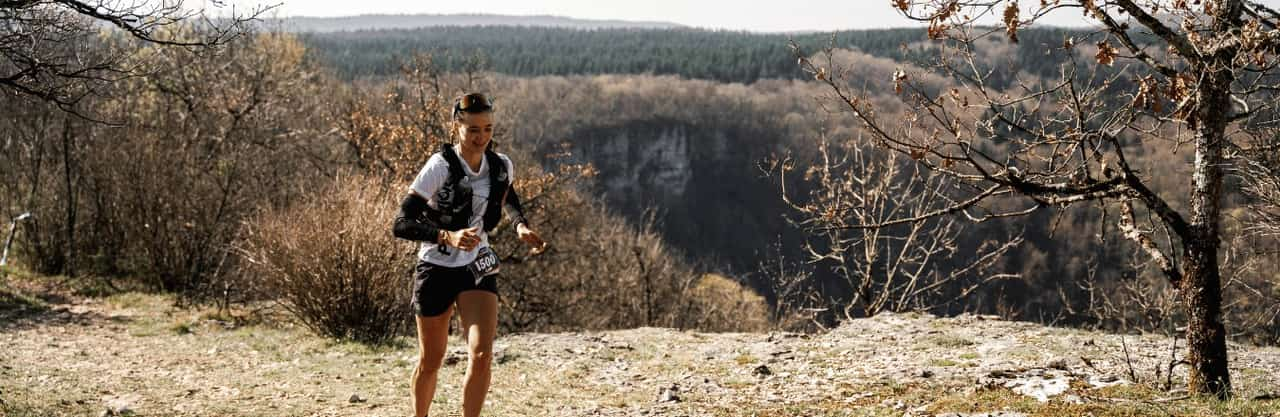
 Image provided by the organizer

Trail du Cirque du Fer à Cheval - 10 km 2027
The forecast arrives five days before the start.
Here you'll find the official elevation profile, an estimated finish time based on your UTMB Index and details of the 2 aid stations to plan your nutrition and hydration segment by segment.
What's your time based on your UTMB?
Times estimated by the RAVIT model, learned from real ultra-trail finish times. Enter your UTMB Index (utmb.world) to get a personalized estimate.

Cut-off times and crew - Trail du Cirque du Fer à Cheval - 10 km · 2027
The race rules prevail. Positions are interpolated along the GPX track and are a guide, not official course marking.
What you'll find at each aid station
| Product | Montignykm 5.6 | Arrivéekm 11.0 |
|---|---|---|
| Oranges | available | available |
| Bananes | available | available |
| Chocolat | available | available |
| Pain d'épices | available | available |
| Madeleine nature | available | available |
| Crackers TUC | available | available |
| Bouillon de légumes | available | available |
| Saint-Yorre (eau minérale) | available | available |
| Abricots secs | available | available |
| Cacahuètes grillées salées | available | available |
| Saucisson · Salaisons Thaurin | available | available |
| Sirop citron · Maison Rième | available | available |
| Sirop sapin · Maison Rième | available | available |
| Sirop menthe · Maison Rième | available | available |
| Jura Cola · Rouget de Lisle | available | available |
| Comté fruité · Fruitière du Plateau Arboisien | available | available |
| Water | available | available |
La feuille de ton assistance pour Trail du Cirque du Fer à Cheval - 10 km · 2027
Ton assistance peut te voir à ces postes. Ton plan RAVIT y met tes heures, ce qu'elle te tend et la route pour y aller.
Recto, verso et planche d'étiquettes, en PDF : l'exemple d'une coureuse de l'UTMB.
Elevation profile
The course and its aid stations
In the 2027 ranking
Trail du Cirque du Fer à Cheval - 10 km is 11 km and 408 m of elevation gain, that's 15 km-effort: category XXS, among 95 races in 2027. Its time limit of 3 h requires a minimum speed of 3.7 km/h: rank 33 out of 88 of the widest cut-off times in XXS.
Short XXS trails 2027: less than 25 km-effort
Similar effort in 2027
- Mountain Ultra Trail - MUT Lite by UTMB · 15 km-effort
- Trail Drôme en Baronnies - Au milieu des oliviers · 15 km-effort
- Tarawera Ultra-Trail - T14 · 15 km-effort
Other trails worth preparing for
- Saint Eusèbe - Trail du Four à Pain15 km · 539 m D+ · October 31, 2026
- Valbonne - 15km-night15 km · 400 m D+ · October 31, 2026
- Orgères - Trail découverte - 15km nocturne14 km · 169 m D+ · October 31, 2026
- Volvic - 16km-night17 km · 648 m D+ · October 31, 2026
- COTTANCE - 12km-night12 km · 350 m D+ · October 31, 2026
- Bouaye - La Loupiote12 km · 80 m D+ · October 31, 2026
- Saint Eusèbe - Trail des Féodières10 km · 268 m D+ · October 31, 2026
- Estialescq - 11km12 km · 210 m D+ · October 31, 2026
- Courzieu - 11km-night11 km · 485 m D+ · October 31, 2026
Sources and method
- Time projection — for lack of results on this race, times by UTMB Index rely on a Riegel law whose exponent is adjusted to elevation gain — the model's fallback, not its usual method. Peter Riegel (Wikipedia)
- Trail nutrition — hourly targets for carbohydrate, fluid and sodium follow the commonly accepted ultra-endurance guidance. La Clinique du Coureur — Fuelling in trail running
- Course, aid stations and cut-offs — taken from the event's official rules, which prevail in case of any discrepancy. Official site — Trail du Cirque du Fer à Cheval - 10 km
Weather for Trail du Cirque du Fer à Cheval - 10 km
The weather for Trail du Cirque du Fer à Cheval - 10 km will appear here as soon as the forecast models reach that date, around five days before the start: feels-like temperature, rain, snow, wind and storms, section by section and at your passage time.
Detailed weather for Trail du Cirque du Fer à Cheval - 10 km, hour by hour on the courseFrequently asked questions
How many checkpoints?
Trail du Cirque du Fer à Cheval - 10 km has 2 checkpoints: 2 aid stations. Details are in the two tables above.
What's the longest segment without aid?
The one leading to Ravito Montigny: 5.6 km and 274 m elevation gain. That's the one to load up for first.
How do I find the exact location of an aid station?
The Google Maps icon in the “Access” column opens the aid station's location: handy for planning your crew's routes.
What distance and elevation gain?
Trail du Cirque du Fer à Cheval - 10 km is 11 km long with 408 m of elevation gain.
How long to finish?
With a UTMB Index of 600 (average runner), the estimated time is around 1h07 for Trail du Cirque du Fer à Cheval - 10 km.
What's the weather forecast?
The weather for Trail du Cirque du Fer à Cheval - 10 km will be published on this page around five days before the start, once the forecast models reach the race date. It will be detailed section by section: feels-like temperature, rain, snow, wind and storms.
Want to stack the odds in your favor for Trail du Cirque du Fer à Cheval - 10 km?
In 2 minutes, RAVIT generates your complete plan: segment-by-segment time, carbs, water and sodium at every aid station, printable roadbook.
No card required · Instant results