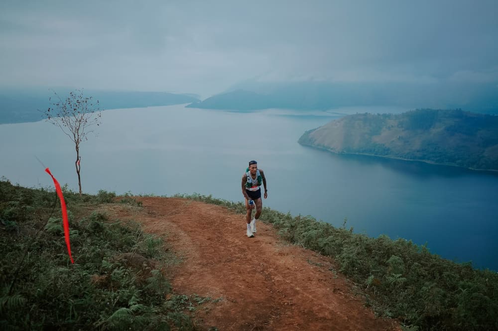
Trail of the Kings - Lake Toba - Ultimate Expedition 60K 2027
在这里你会找到海拔高度曲线图、根据你的UTMB Index的完赛时间估计,以及8个补给站的详细信息,方便你逐路段规划营养和补水。
根据你的 UTMB Index,完赛时间是多少?
关门时间和协助 - Trail of the Kings - Lake Toba - Ultimate Expedition 60K · 2027
数据来自官方比赛规程,每届均会核实。以比赛规程为准。位置根据 GPX 轨迹插值,仅供参考,不是官方路标。
每个补给站提供什么
| 产品 | Sitao-tao8.6 km处 | Pusuk Buhit13.0 km处 | Geopark Information Center19.9 km处 | SMAN 1 Sianjur Mula Mula25.9 km处 | Ginolat33.9 km处 | Bonan Dolok46.0 km处 | Bukit Burung56.8 km处 | Finish64.9 km处 |
|---|---|---|---|---|---|---|---|---|
| 水 | 提供 | 提供 | 提供 | 提供 | 提供 | 提供 | 提供 | 提供 |
| 品牌产品 | 提供 | 提供 | 无 | 提供 | 提供 | 提供 | 提供 | 无 |
| 热餐 | 无 | 无 | 提供 | 无 | 无 | 无 | 无 | 提供 |
海拔剖面
路线及其补给站
Trail of the Kings - Lake Toba - Ultimate Expedition 60K:按 UTMB® 指数的时间、停留与补给需求
UTMB® 指数从 500 到 800,这条赛道的推算完赛时间在 13h20 到 7h07 之间。这些时间已包含补给站的停留时间:它们来自两个计时点之间的实际用时,本赛事的计时并未单独记录停留时间。
来源
| UTMB® 指数 | 推算时间 | 夜间时长 | 碳水 | 液体 | 钠 | 关门余量 |
|---|---|---|---|---|---|---|
| 500 | 11h56 至 13h20 | 1 | 758 g | 8.8 L | 6,317 mg | +7h22 |
| 550 | 11h13 至 12h33 | 1 | 713 g | 8.3 L | 5,942 mg | +8h07 |
| 600 | 10h50 至 12h08 | 1 | 689 g | 8 L | 5,742 mg | +8h31 |
| 650 | 9h39 至 10h47 | 1 | 613 g | 7.2 L | 5,108 mg | +9h47 |
| 700 | 8h29 至 9h29 | 1 | 539 g | 6.3 L | 4,492 mg | +11h01 |
| 750 | 7h41 至 8h35 | 1 | 488 g | 5.7 L | 4,067 mg | +11h52 |
| 800 | 7h07 至 7h57 | 1 | 452 g | 5.3 L | 3,767 mg | +12h28 |
按每小时 60 克碳水、700 毫升液体、500 毫克钠计算,训练状态为「中等」,气温适中(15–25 °C)。超过 25 °C 时约需 900 mL/h 与 700 mg/h。碳水耐受需要训练:60 g/h 是下限,90 g/h 需要葡萄糖-果糖配比和已适应的肠道。
第2026届的实测数据:逐个计时站点看选手群体
142名起跑者,弃赛率8.5%,8个计时站点。
| 路段 | km | 中位数 | 中间半部分 | 测得 |
|---|---|---|---|---|
| Waterfront City Pangururan → Sitao-tao | 8.6 | 1小时 18 | 1小时 12 – 1小时 27 | 141 |
| Sitao-tao → Pusuk Buhit | 13.1 | 1小时 46 | 1小时 41 – 1小时 59 | 54 |
| Pusuk Buhit → Geopark | 20 | 1小时 22 | 1小时 13 – 1小时 30 | 54 |
| Geopark → SMA N 1 Sianjur Mula Mula | 26.7 | 1小时 10 | 1小时 00 – 1小时 21 | 142 |
| SMA N 1 Sianjur Mula Mula → Ginolat | 33.9 | 2小时 56 | 2小时 34 – 3小时 30 | 141 |
| Ginolat → Bonan Dolok | 46.1 | 4小时 11 | 3小时 47 – 4小时 34 | 132 |
| Bonan Dolok → Bukit Burung | 56.8 | 2小时 28 | 2小时 11 – 2小时 44 | 129 |
| Bukit Burung → Waterfront City Panguruan | 65 | 1小时 41 | 1小时 28 – 1小时 58 | 130 |
在哪里弃赛。 Ginolat (8) · Bonan Dolok(3) · SMA N 1 Sianjur Mula Mula(1) 占总弃赛人数12。
RAVIT 记录,来自第2026届的官方计时,数据时间为2026年9月15日。
来源
其他值得准备的越野赛
- BE-RARI CROSS COUNTRY ULTRA - BE-RARI 50K54 km · 3,400 m D+ · 2026年11月22日
- Gede Pangrango 100 - 100 KM102 km · 10,534 m D+ · 2026年12月4日
- Siksorogo Lawu Ultra - TRAIL 50KM50 km · 4,106 m D+ · 2026年12月4日
- Gede Pangrango 100 - 50 KM51 km · 5,269 m D+ · 2026年12月5日
- Bali Coast Trail - BCT5050 km · 2,656 m D+ · 2026年12月12日
- ROOF OF TULUNGAGUNG - 50KM55 km · 4,175 m D+ · 2026年12月19日
- LELONO - 55K55 km · 3,712 m D+ · 2027年1月16日
- Tahura Djuanda Trail Running Race - TTRR 42K43 km · 2,248 m D+ · 2027年1月30日
- Merumatta Coast Trail - Merumatta 50k47 km · 3,143 m D+ · 2027年1月31日
历年 Trail of the Kings - Lake Toba - Ultimate Expedition 60K
来源与方法
- 时间推算 — 按 UTMB Index 的配速取自该赛事前几届各能力段选手的实际通过时间,已计入补给站停留时间。只要这些成绩数据存在,就不采用任何公式。
- 越野跑营养 — 碳水、液体与钠的每小时目标,采用超耐力运动中普遍认可的参考区间。 La Clinique du Coureur — 越野跑中的进食
- 赛道、补给与关门 — 取自赛事官方竞赛规程;如有出入,以规程为准。 官方网站 — Trail of the Kings - Lake Toba - Ultimate Expedition 60K
Trail of the Kings - Lake Toba - Ultimate Expedition 60K 天气预报
Trail of the Kings - Lake Toba - Ultimate Expedition 60K 的天气预报将在预报模型覆盖该日期后发布于此,大约在起跑前五天:体感温度、雨、雪、风和雷暴,按赛段逐段呈现,并对应你的通过时刻。
Trail of the Kings - Lake Toba - Ultimate Expedition 60K 详细天气,赛道逐小时预报常见问题
有多少个通过点?
Trail of the Kings - Lake Toba - Ultimate Expedition 60K 共有 8 个通过点:8 个补给站。详细信息在上面两个表格中。
没有补给站的最长路段是哪一段?
通往Bonan Dolok的这段:12.1 km,累计爬升709 m。这一段最需要多带补给。
如何找到补给站的准确位置?
「通道」栏中的 Google 地图图标会打开该补给站的位置,方便协助团队规划路线。
距离和累计爬升是多少?
Trail of the Kings - Lake Toba - Ultimate Expedition 60K 全长 65 公里,爬升 3266 米。
需要多长时间完赛?
UTMB 指数为 600(中等跑者)时,Trail of the Kings - Lake Toba - Ultimate Expedition 60K 有一半跑者在 10h50 至 12h08 之间完赛。
预报天气如何?
Trail of the Kings - Lake Toba - Ultimate Expedition 60K 的天气预报将在起跑前约五天发布于本页面,届时预报模型将覆盖比赛日期。天气将按赛段逐段呈现:体感温度、雨、雪、风和雷暴。