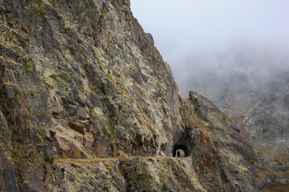
Nice Côte d'Azur - 100M - Ultra Trail Métropole Nice Côte d'Azur 2026
The forecast arrives five days before the start.
Here you'll find the elevation profile, an estimated finish time based on your UTMB Index and details of the 16 aid stations to plan your nutrition and hydration segment by segment.
What's your time based on your UTMB?
Times estimated by the RAVIT model, learned from real ultra-trail finish times. Enter your UTMB Index (utmb.world) to get a personalized estimate.
Predicted race time based on your UTMB Index® · smoothed times achieved by runners at your level in past editions


Cut-off times and crew - Nice Côte d'Azur - 100M - Ultra Trail Métropole Nice Côte d'Azur · 2026
Data from the official race rules, checked for every edition. The race rules prevail. Positions are interpolated along the GPX track and are a guide, not official course marking.
What you'll find at each aid station
| Product | Saint-Etienne de Tinéekm 8.2 | Cabane des chasseurskm 16.6 | Collelonguekm 30.3 | Isola villagekm 38.9 | Pont de Paulekm 51.4 | Saint Sauveur sur Tinéekm 65.0 | Rimplaskm 69.7 | Venansonkm 84.8 | Granges de la Brasquekm 95.2 | Utellekm 112.4 | Levenskm 124.4 | Chapelle St Michelkm 130.9 | Tourrette-Levenskm 143.0 | Drapkm 150.0 | Plateau Saint Michel / Villefrance sur Merkm 159.1 | Nice - Promenade des Anglaiskm 169.8 |
|---|---|---|---|---|---|---|---|---|---|---|---|---|---|---|---|---|
| Water | available | available | available | available | available | available | available | available | available | available | available | available | available | available | available | available |
| Brand products · Näak | unavailable | available | available | available | available | unavailable | available | available | available | available | unavailable | available | available | available | available | unavailable |
| Hot meal | unavailable | unavailable | unavailable | unavailable | unavailable | available | unavailable | unavailable | unavailable | unavailable | available | unavailable | unavailable | unavailable | unavailable | available |
Elevation profile
The course and its aid stations
Nice Côte d'Azur - 100M - Ultra Trail Métropole Nice Côte d'Azur: times, aid-station stops and fuelling needs by UTMB® Index
Between a UTMB® Index of 500 and 800, the estimated finish time on this race runs from 42h46 to 23h32, and the aid-station stop budget from 3h00 to 0h52. The longer the race, the more stops weigh: this is time you should plan to spend standing still, not only running.
Source| UTMB® Index | Estimated time | Of which stops | Night hours | Carbs | Fluid | Sodium | Cut-off margin |
|---|---|---|---|---|---|---|---|
| 500 | 42h46 | 3h00 | 20 | 2,566 g | 29.9 L | 21,383 mg | +7h14 |
| 550 | 39h02 | 2h45 | 17 | 2,342 g | 27.3 L | 19,517 mg | +10h58 |
| 600 | 35h46 | 2h30 | 13.8 | 2,146 g | 25 L | 17,883 mg | +14h14 |
| 650 | 32h26 | 2h02 | 10.4 | 1,946 g | 22.7 L | 16,217 mg | +17h34 |
| 700 | 28h59 | 1h34 | 10 | 1,739 g | 20.3 L | 14,492 mg | +21h01 |
| 750 | 27h26 | 1h15 | 10 | 1,646 g | 19.2 L | 13,717 mg | +22h34 |
| 800 | 23h32 | 0h52 | 10 | 1,412 g | 16.5 L | 11,767 mg | +26h28 |
Figures based on 60 g of carbohydrate, 700 mL of fluid and 500 mg of sodium per hour, "average" preparation and mild conditions (15–25 °C). Above 25 °C, count on roughly 900 mL/h and 700 mg/h. Carbohydrate intake is trained: 60 g/h is a floor, 90 g/h assumes a glucose-fructose blend and a gut used to it.
Measured on the 2026 edition: the field checkpoint by checkpoint
957 starters, 40.9% DNF rate, 18 timed checkpoints.
| Segment | km | Median | Middle half | Measured | Median passage | Still ranked |
|---|---|---|---|---|---|---|
| Auron → Saint Étienne de Tinée | 8.2 | 58 min | 53 min – 1 h 04 | 938 | 58 min | 957 |
| Saint Étienne de Tinée → Cabane des chasseurs | 16.5 | 2 h 09 | 1 h 58 – 2 h 23 | 936 | 3 h 04 | 955 |
| Cabane des chasseurs → Collelongue | 30.3 | 2 h 57 | 2 h 35 – 3 h 16 | 945 | 5 h 57 | 945 |
| Collelongue → Isola | 39 | 1 h 55 | 1 h 39 – 2 h 09 | 855 | 7 h 46 | 921 |
| Isola → Pont De Paule | 51.5 | 2 h 45 | 2 h 23 – 3 h 11 | 778 | 10 h 33 | 848 |
| Pont De Paule → St Sauveur sur Tinée | 65.1 | 3 h 03 | 2 h 38 – 3 h 31 | 794 | 13 h 34 | 802 |
| St Sauveur sur Tinée → Rimplas | 69.7 | 1 h 39 | 1 h 21 – 1 h 57 | 721 | 15 h 21 | 725 |
| Rimplas → Venanson | 84.8 | 3 h 23 | 2 h 58 – 3 h 45 | 710 | 18 h 48 | 715 |
| Venanson → Granges de la Brasque | 95.1 | 3 h 02 | 2 h 40 – 3 h 35 | 667 | 21 h 51 | 673 |
| Granges de la Brasque → Bouche des Fournès | 102.1 | — | — – — | 0 | — | 662 |
| Bouche des Fournès → Utelle | 112.4 | — | — – — | 0 | 25 h 28 | 662 |
| Utelle → Levens | 124.4 | 2 h 35 | 2 h 16 – 2 h 56 | 616 | 27 h 59 | 619 |
| Levens → Mont Férion | 129.8 | — | — – — | 0 | — | 584 |
| Mont Férion → Chapelle St Michel | 131 | — | — – — | 0 | 30 h 48 | 584 |
| Chapelle St Michel → Tourette-Levens | 143 | 2 h 43 | 2 h 18 – 3 h 17 | 574 | 33 h 30 | 578 |
| Tourette-Levens → Drap | 150 | 1 h 58 | 1 h 35 – 2 h 20 | 563 | 35 h 32 | 568 |
| Drap → Plateau Saint-Michel | 159.2 | 2 h 20 | 1 h 58 – 2 h 39 | 565 | 38 h 03 | 567 |
| Plateau Saint-Michel → Nice | 169.6 | 1 h 57 | 1 h 41 – 2 h 14 | 566 | 40 h 12 | 566 |
“Median passage” is elapsed time from the start, not a clock time: the clock time depends on the edition.
Where runners drop out. St Sauveur sur Tinée (77) · Isola (73) · Pont De Paule (46) out of 391 total DNFs.
RAVIT record from the official timing of the 2026 edition, data from September 29, 2026.
SourceOther trails worth preparing for
- THP winter - W100102 km · 5,306 m D+ · November 21, 2026
- ULTRA TRAIL TROUPES DE MARINE - 128KM131 km · 4,673 m D+ · November 21, 2026
- Lyon SaintéLyon164 km · 4,239 m D+ · November 28, 2026
- Les Herbiers - La HOT du Père Noël135 km · 3,109 m D+ · December 19, 2026
- Les Courses du Père Noël - La HOT - circuit delestage 120km117 km · 2,350 m D+ · December 19, 2026
- UTDF - Ultra Trail Des Fontaines105 km · 4,271 m D+ · February 6, 2027
- Ultra Trail des Vallees - UTDV 130 Km128 km · 3,022 m D+ · March 20, 2027
- Salomon EcoTrail Paris - Printemps - Trail 120km120 km · 1,618 m D+ · March 20, 2027
- Grand Trail des Cadourques - GTC124 km · 4,298 m D+ · April 2, 2027
Sources and method
- Time projection — times by UTMB Index are taken from the actual splits of runners in each level band on previous editions of this race, aid station stops included. No formula is used as long as these results exist.
- Trail nutrition — hourly targets for carbohydrate, fluid and sodium follow the commonly accepted ultra-endurance guidance. La Clinique du Coureur — Fuelling in trail running
- Course, aid stations and cut-offs — taken from the event's official rules, which prevail in case of any discrepancy. Official site — Nice Côte d'Azur - 100M - Ultra Trail Métropole Nice Côte d'Azur
Weather for Nice Côte d'Azur - 100M - Ultra Trail Métropole Nice Côte d'Azur
The weather for Nice Côte d'Azur - 100M - Ultra Trail Métropole Nice Côte d'Azur will appear here as soon as the forecast models reach that date, around five days before the start: feels-like temperature, rain, snow, wind and storms, section by section and at your passage time.
Detailed weather for Nice Côte d'Azur - 100M - Ultra Trail Métropole Nice Côte d'Azur, hour by hour on the courseFrequently asked questions
How many checkpoints?
Nice Côte d'Azur - 100M - Ultra Trail Métropole Nice Côte d'Azur has 17 checkpoints: 15 aid stations, 1 water point, and 1 checkpoint with undocumented contents. Details are in the two tables above.
What's the longest segment without aid?
The one leading to Utelle: 17.3 km and 195 m elevation gain. That's the one to load up for first.
How do I find the exact location of an aid station?
The Google Maps icon in the “Access” column opens the aid station's location: handy for planning your crew's routes.
What distance and elevation gain?
Nice Côte d'Azur - 100M - Ultra Trail Métropole Nice Côte d'Azur is 170 km long with 8609 m of elevation gain.
How long to finish?
With a UTMB Index of 600 (average runner), the estimated time is around 35h46 for Nice Côte d'Azur - 100M - Ultra Trail Métropole Nice Côte d'Azur.
What's the weather forecast?
The weather for Nice Côte d'Azur - 100M - Ultra Trail Métropole Nice Côte d'Azur will be published on this page around five days before the start, once the forecast models reach the race date. It will be detailed section by section: feels-like temperature, rain, snow, wind and storms.
Want to stack the odds in your favor for Nice Côte d'Azur - 100M - Ultra Trail Métropole Nice Côte d'Azur?
In 2 minutes, RAVIT generates your complete plan: segment-by-segment time, carbs, water and sodium at every aid station, printable roadbook.
No card required · Instant results